
Home · Elie Chain Walk
The Elie Chain Walk
Live tide windows for Scotland’s wildest shoreline scramble, and everything to know before you grab the first chain.
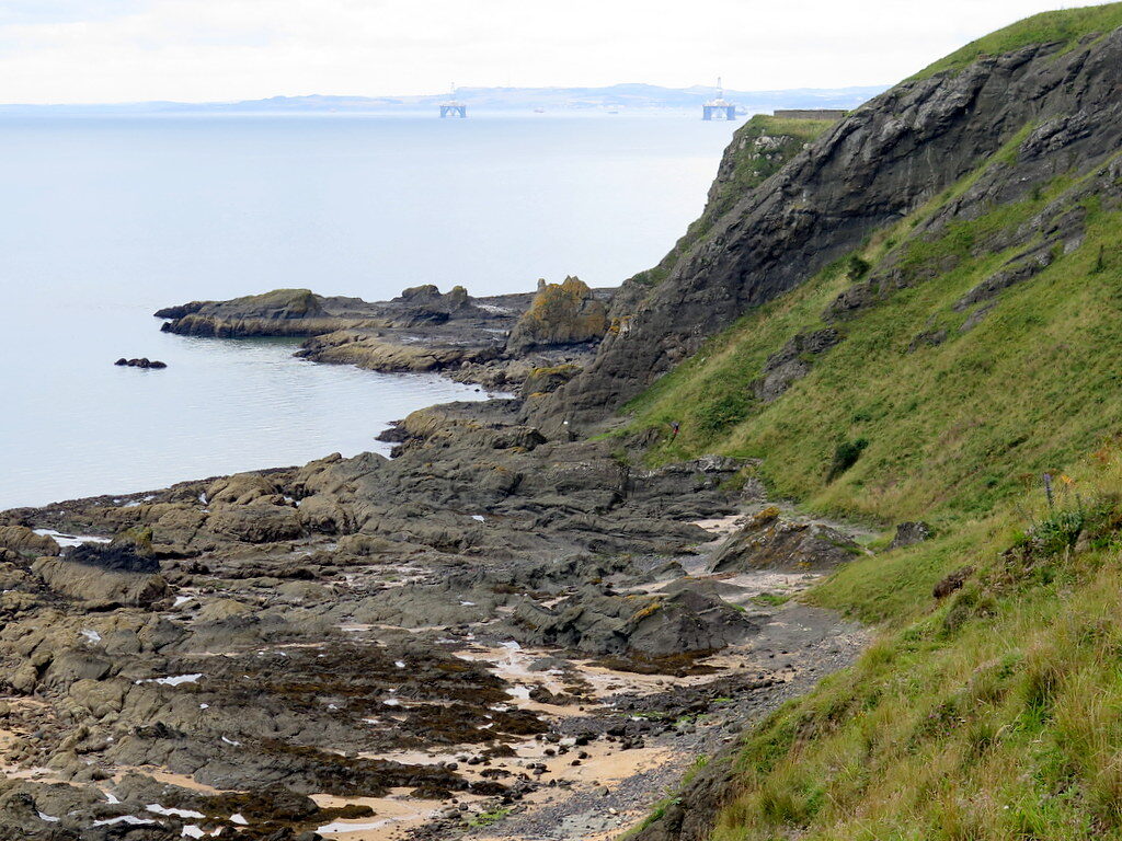
Photo: Ian Paterson, CC BY-SA 2.0
The Elie Chain Walk is a scramble along the base of the Kincraig cliffs between Earlsferry and Shell Bay in Fife: eight fixed chains and steps cut into the volcanic rock, threading coves and headlands that are fully underwater at high tide. That makes the tide table part of the kit list: the walk is commonly advised only within about two hours either side of low water, ideally started as the tide falls. The planner below shows this week’s safe windows from official UKHO tide predictions.
Why people come back to it: for an hour you are on a sea cliff with the water a few feet below, moving hand over hand on chains a century old, through caves and gullies and under a wall of basalt columns, and then you walk off the far end onto a beach. It needs no ropes and no experience beyond a head for heights and a pair of hands, which is why it has been Fife’s favourite small adventure since the 1920s, and why the same tide that makes it possible has to be respected. Get the window right and it is one of the best mornings on the Scottish coast.
What is the Chain Walk?
Part via ferrata, part rock-hop, the Chain Walk crosses roughly a third of a mile of cliff-foot between the sand at Earlsferry and Shell Bay, under Kincraig Point’s columned volcanic cliffs. It has been here for a century: in the 1920s the residents of Elie and Earlsferry raised the money to open up the Point, and a local blacksmith cut the steps and fixed the chains: eight of them, numbered from the Earlsferry end. Today it is a famous stretch of the wider East Neuk coast and one of the most distinctive short adventures in Scotland. The cliffs are riddled with caves along the way. Legend ties one of them, Macduff’s Cave, to the Thane of Fife hiding here from Macbeth before fleeing across the Forth.
Route, time and getting there
- Parking, Earlsferry side: spaces at the west end of Earlsferry High Street and by the golf course on Chapel Green Road, then walk west along the sands to the Point; the first chain is at the west end of Earlsferry beach. From Elie itself, allow the best part of an hour to reach it on foot.
- Parking, Shell Bay side: a free public car park sits just before the Elie Holiday Park gate at Shell Bay, a shorter approach to the western end of the chains, walking the route east-bound.
- Coming back: you don’t retrace the chains: most walkers make a circuit, taking the Fife Coastal Path over Kincraig Hill for the return leg, past the wartime bunkers on the top. The full loop is about 3½ miles; give it 2–3 hours all in.
- The chained section: about a third of a mile, but plan on around an hour of climbing and scrambling, more with children or a camera.
- Hands and feet: grippy footwear that can get wet, both hands free, nothing loose. The rock is polished in places and greasy when wet, and gloves earn their keep on a cold or wet chain.
- Escape: once committed between headlands, options are limited, which is why the tide window matters more here than on any beach walk.
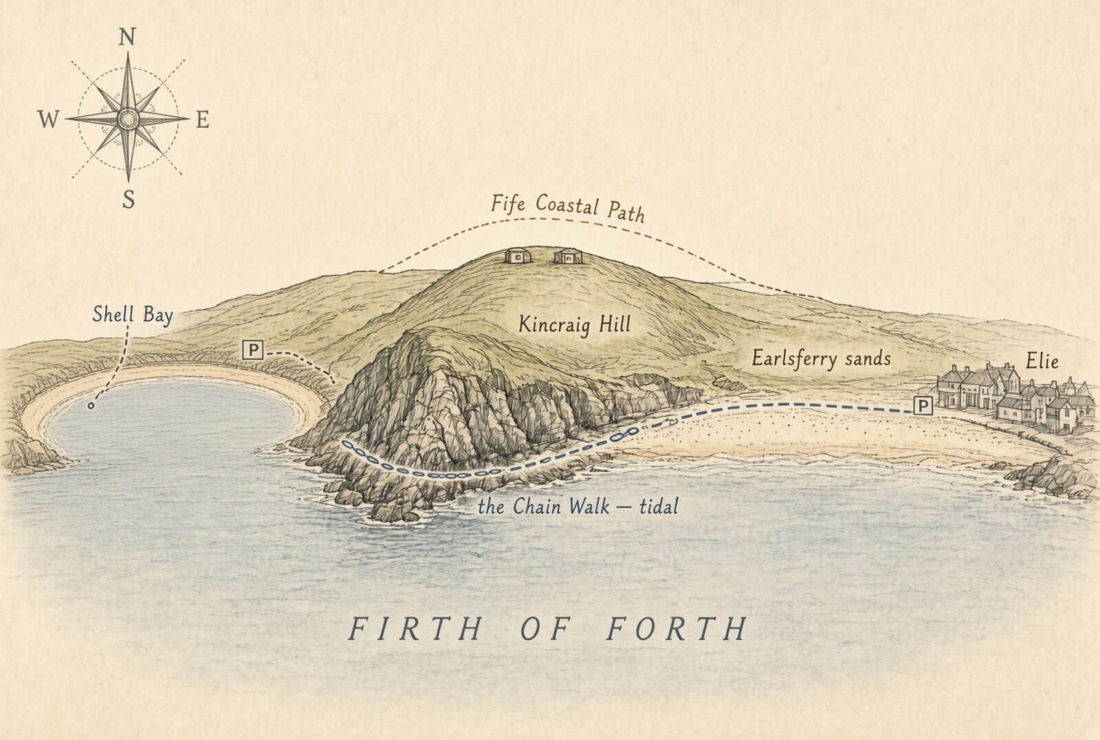
The eight chains, east to west
Each chain has its own character. This is the classic east-to-west order, starting from Earlsferry sands. Throughout: face the rock on the climbs, keep the chain between your legs on the vertical descents, and watch for loose grit on the cut steps.
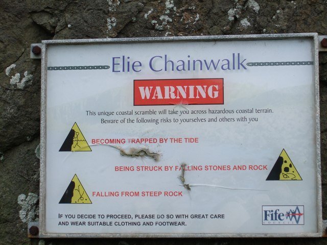
- Chain 1: a short climb past the warning notice, then a longer descent into Macduff’s Cave inlet and a horizontal run along the cliff foot. At low water much of it can be bypassed on the shingle below.
- Chain 2: the climb out of the inlet, angled awkwardly against the cliff. Many reckon it the hardest move of the day. Staggered ledges and obvious footholds see you up. Beyond, cut steps cross a rise to a shingle beach beneath a vast sweep of basalt columns.
- Chain 3: a short chain over a low band of rock, then a gritty slope up to a metal post.
- Chain 4: a roughly ten-metre vertical descent to the next bay: the steepest drop of the route, with footholds that thin out near the bottom.
- Chain 5: a short climb to a knife-edge of rock barely wide enough to pause on. The view is the reward.
- Chain 6: a long descent that steepens to vertical partway down; good steps at the top, care needed lower.
- Chain 7: a horizontal chain above a narrow foot-ledge, running in toward Doos’ Cave.
- Chain 8: one final short, vertical pull, then easy rocky ribs to the western end near the Devil’s Cave and Shell Bay.
The walk in pictures
East to west, in the order you meet it. Every frame is a real photograph of the route, shared by the people who took it under a Creative Commons licence. The credits are part of the deal.
- 01
The way in
From Earlsferry sands the path runs west along the foot of Kincraig Hill to the start. The rock ahead is the whole route; everything you can see from here is tidal.
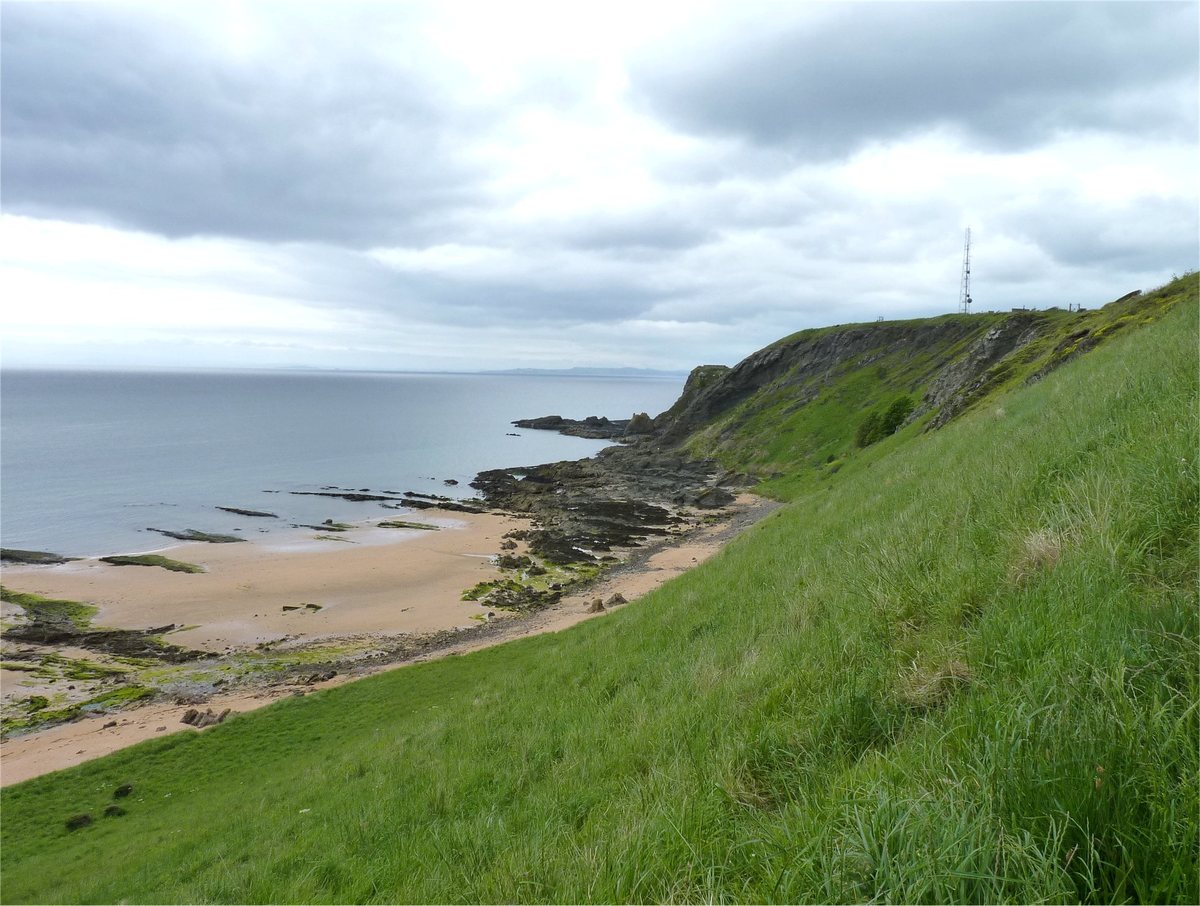
Kincraig Hill and the shore where the walk begins. Photo: James Allan, CC BY-SA 2.0 - 02
Chain 1: into Macduff’s Cave inlet
A short climb past the warning notice, then the first real chain: a longer descent into the inlet below Macduff’s Cave, where the Thane of Fife is said to have hidden from Macbeth. The same scramble, forty-four years apart: rusty iron then, stainless steel now.
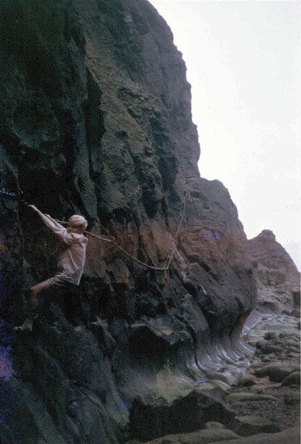
1963: the original chains, hung in 1929. Photo: James Allan, CC BY-SA 2.0 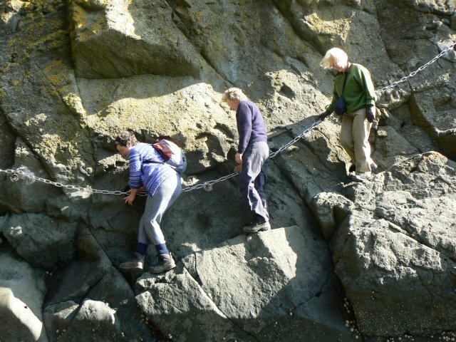
2007: the same entry, re-equipped. Photo: James Allan, CC BY-SA 2.0 - 03
Chain 2: out of the inlet and along the cliff foot
The climb out is angled awkwardly against the rock and many reckon it the hardest move of the day. Beyond it the chains run horizontal, a few feet above the water, along the cliff foot near the eastern end.
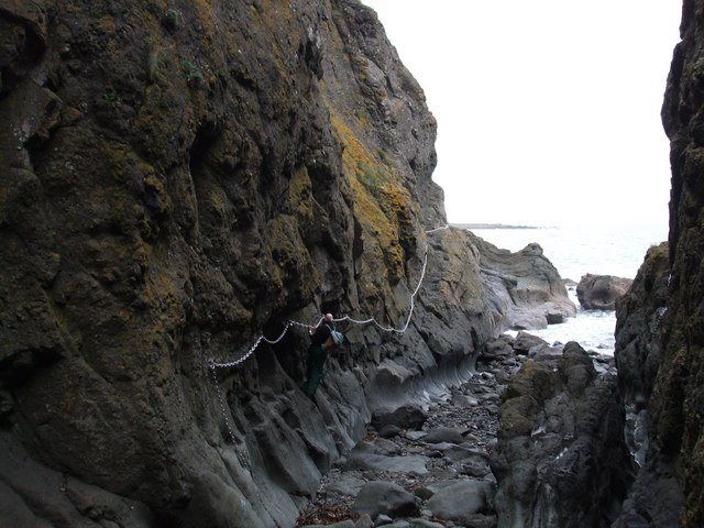
The horizontal traverse near the east end, just above the sea. Photo: ronnie leask, CC BY-SA 2.0 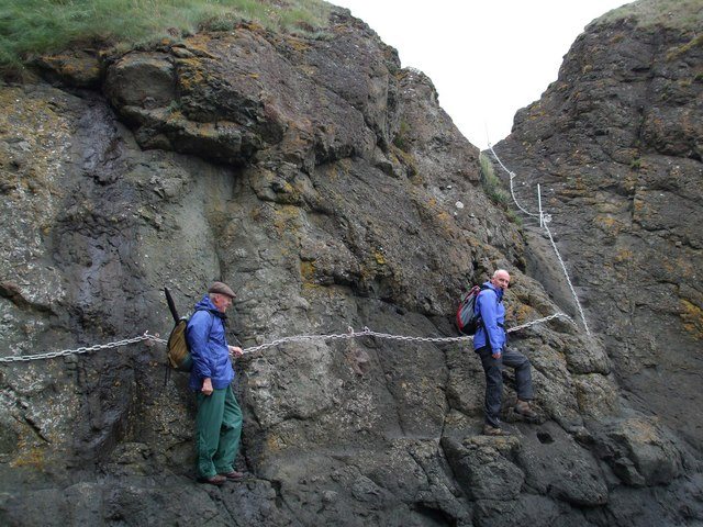
Hands on the chain: face the rock, keep three points of contact. Photo: ronnie leask, CC BY-SA 2.0 - 04
Beneath the Organ Pipes
Cut steps cross a rise to a shingle beach under a vast sweep of basalt columns, the same rock as Fingal’s Cave and the Giant’s Causeway, and the reason geologists come here without any interest in the chains. Chain 3 is the short one over the low band of rock at the far side.
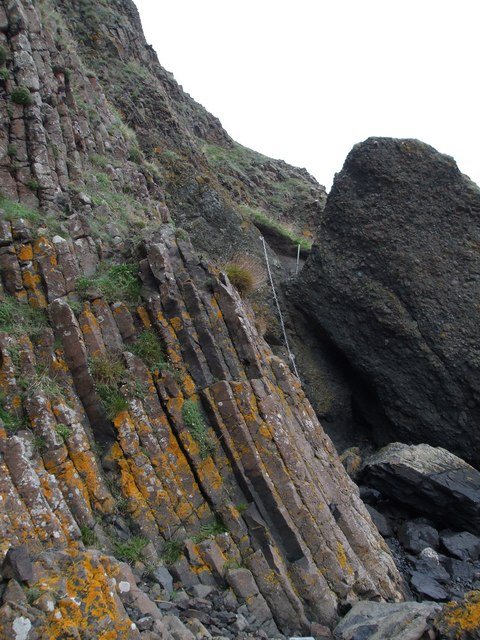
The Organ Pipes; a section of chain shows on the right. Photo: ronnie leask, CC BY-SA 2.0 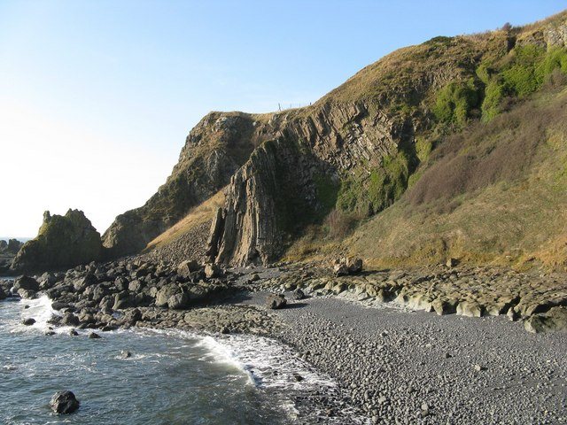
The stone beach below the columns. Photo: Margot Manson, CC BY-SA 2.0 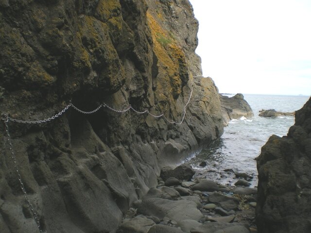
Chains across the columned rock. Photo: Richard Law, CC BY-SA 2.0 - 05
Chains 4 to 6: the steep ones
Chain 4 is the roughly ten-metre vertical descent, the biggest drop of the route; chain 5 a short climb to a knife-edge; chain 6 a long descent that steepens to vertical partway down. This is climbing, not strolling: chain between your legs on the way down, and look at where your feet go, not at the sea.
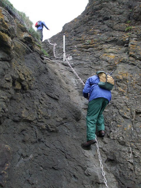
One of the vertical chains. Photo: ronnie leask, CC BY-SA 2.0 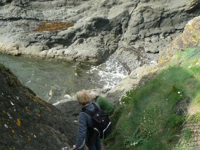
Descending towards the water: the sea is never far below. Photo: James Allan, CC BY-SA 2.0 - 06
Chain 7: the ledge to Doos’ Cave
A horizontal chain above a narrow foot-ledge runs in toward the Doo Cave, the pigeons’ cave, whose mouth dwarfs a walker. The cliffs here are riddled with caves and gullies, and a vertical chain climbs out of one of them.
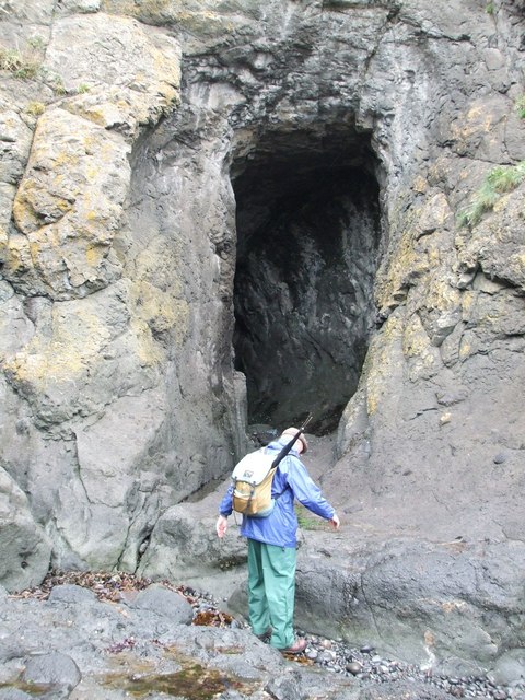
The Doo Cave. Photo: ronnie leask, CC BY-SA 2.0 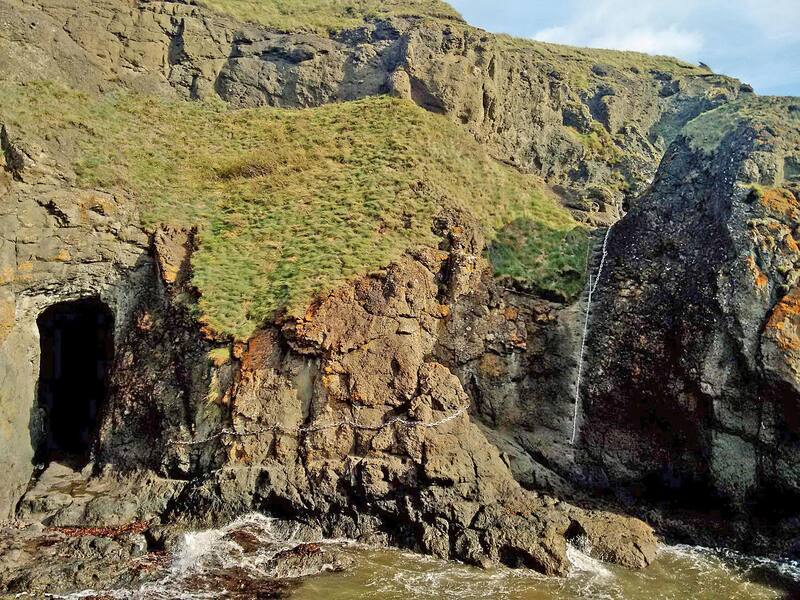
Cave, traverse and the vertical chain up the gully in one frame. Photo: Claire Pegrum, CC BY-SA 2.0 - 07
Chain 8: the Devil’s Cave and the western end
One final short vertical pull, then easy rocky ribs past the Devil’s Cave to the western end and Shell Bay. Turn round here and the whole cliff you have just crossed stretches back east towards Earlsferry.
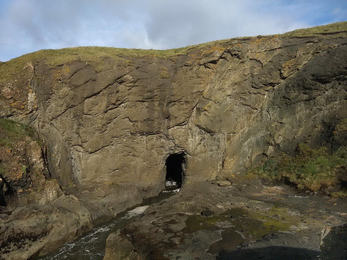
The Devil’s Cave, near the western end. Photo: Claire Pegrum, CC BY-SA 2.0 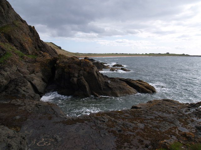
Looking back east along the route towards Earlsferry Links. Photo: John Clive Nicholson, CC BY-SA 2.0
How do I get there?
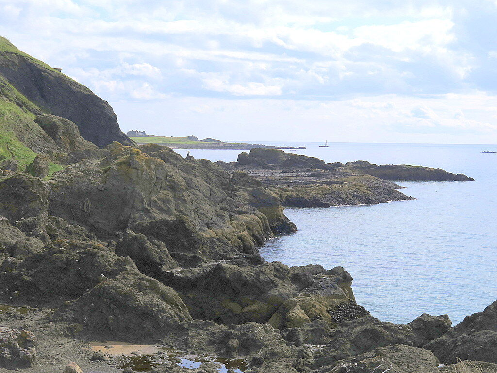
Elie and Earlsferry sit together on the Fife coast road, about twenty minutes south of St Andrews and just over an hour from Edinburgh. For the classic direction, park at the west end of Earlsferry High Street or by the golf course on Chapel Green Road and walk west along the sands; for the shorter western approach, use the free car park at the Elie Holiday Park gate, Shell Bay. The map below centres on Kincraig Point itself for the drive in; the route picture above shows how the walks and car parks relate. No car? Stagecoach’s coastal buses between Leven and St Andrews stop on Elie High Street, and the nearest railway station is Kirkcaldy.
If the tide is wrong: the clifftop alternative
The Fife Coastal Path climbs over the top of Kincraig Hill between Earlsferry and Shell Bay, so a closed tide window doesn’t end the outing: the high route serves big Forth views and brings you out at the same place. Wrong-tide days are also exactly the days the rest of this coast shines: the East Neuk villages are twenty minutes away.
Take the tide seriously
The Chain Walk is loved, and it is also a regular customer of the emergency services: a significant share of Anstruther lifeboat call-outs are to people caught out here, so many that the crew publish a dedicated Chainwalk safety page. The pattern is nearly always the same: starting too late on a rising tide. The rules that keep you off the lifeboat’s list: go around low water, start on the falling tide, never race a rising one, and if you’re trapped, stay put and call 999 for the Coastguard rather than climbing. Reading the sea is a skill worth having on any shore. Our guide to reading the tides explains the moon-and-minute mechanics behind the windows above.
Chain Walk questions, answered
What are the tide times for the Chain Walk today?
They change every day, which is why this page computes them live: the panel at the top shows today’s and this week’s safe windows from official UKHO low-water predictions: roughly two hours either side of low tide, ideally started on the falling tide.
How hard is it?
A genuine scramble rather than a walk: several chains hang down near-vertical rock, you haul yourself up and down using arms as well as legs, and there are cut steps and traverses above water. Reasonable fitness, a head for heights and both hands free are the entry requirements: no ropes or experience needed beyond that.
Can children do the Chain Walk?
Confident, sure-footed older children manage it well with close supervision, but it is not for small children: the reaches between the cut steps are adult-sized, and carrying a child leaves you without the two free hands the route demands.
Can I take a dog?
Better not. There is no rule against it, but vertical chains and cut steps are no place for a dog. On wrong-tide days and dog days alike, the Fife Coastal Path over Kincraig Hill is the route.
Is the Chain Walk free?
Completely: no fee, no gate, no booking. It is simply an open, chained stretch of the Fife coast, maintained for public use since the 1920s.
Which end should I start from?
Either works. The chains are numbered from the Earlsferry end, and walking east-to-west off Earlsferry sands is the classic direction; starting from the Shell Bay car park is the shorter approach. Direction matters far less than the tide window.
What if the tide is in when I arrive?
Take the clifftop alternative above: the Fife Coastal Path over Kincraig Hill links the same two ends with no chains and big Forth views. Never start against a rising tide to “fit it in”.
Official information & further reading
- Fife Coast & Countryside Trust: the body that manages the Fife Coastal Path, of which the Chain Walk is an optional tidal section (the chains themselves were renewed in 2010).
- WalkHighlands: Elie Chain Walk: the detailed route description walkers use, with maps and reports.
- UKHillwalking route card: grade and logbook notes from a climbing perspective.
While you’re at this end of the coast
Kincraig Point is the western gate of our home shore. The same low tides that open the chains open the foraging ground: Elie’s ledges and the rock shelves east of it are where our seaweed foraging workshops run, timed to the same spring lows the tide planner tracks. If the Chain Walk is the morning, a shore lunch you gathered yourself makes a fair afternoon.